 Indonesia denies foreign claim to rescued orangutans
 Turkey hosts COP31 climate talks in Antalya.
 Pope meets Argentine bishops.
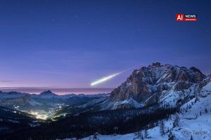
 APOD: 2026 November 8 – Major Fireball Meteor
 Indonesian Horror Hit ‘Pabrik Gula’ Gets 2028 Sequel as MD Entertainment Lines Up Three Imax Films
New Mexico storms collapse Needle and Split Rock formations
**
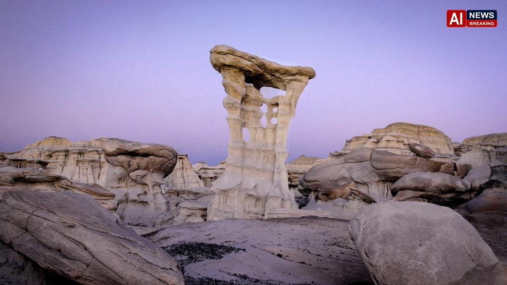
Desert icons collapse as southwestern US gets pummeled with rain and flooding - AI News Breaking
The remote high desert of north‑west New Mexico has been dramatically altered by a series of severe storms that have battered the region with unprecedented rainfall, leading to widespread flooding and the collapse of two of its most photographed natural landmarks. The formations, known locally as “The Needle” and “The Split Rock,” had stood for millennia as silent sentinels over the arid landscape, drawing hikers, photographers and tourists from across the United States and abroad. Their sudden disappearance has sparked a mixture of awe, sorrow and scientific interest as experts scramble to understand the forces that brought them down and to assess the broader implications for the fragile desert ecosystem.The storm system that struck the area in the past week was the result of an unusual confluence of atmospheric patterns..
A deep low‑pressure trough off the Pacific coast merged with a moisture‑laden Gulf of Mexico front, funneling an estimated 3‑4 inches of rain into a region that typically receives less than ten inches annually. The deluge caused flash floods in the Rio Puerco basin and overwhelmed dry riverbeds that had not seen such volumes of water in recorded history. Local authorities reported that the water levels rose at a rate of three feet per minute in some canyons, turning normally walkable trails into dangerous torrents within hours.As the floodwaters surged through the narrow canyons, they exerted a force that exceeded the structural integrity of the sandstone pillars that compose The Needle and The Split Rock..
Both formations were composed of layers of soft, erodible sandstone interbedded with harder siltstone, a geology that made them particularly vulnerable to rapid water infiltration. When the water forced its way into the natural cracks and fissures, it acted as a hydraulic wedge, prying the rock apart. By the early afternoon of Thursday, eyewitnesses on the ground reported hearing a deep, resonant crack followed by a cascade of stone as the formations gave way.The loss of these icons has immediate cultural and economic repercussions for the surrounding communities..
The nearby town of Gallup, which has long promoted the rock formations as part of its tourism strategy, anticipates a sharp decline in visitor numbers during the upcoming peak season. Local businesses, from outfitters to bed‑and‑breakfast establishments, have expressed concern that the absence of these attractions could translate into a loss of revenue amounting to hundreds of thousands of dollars. The New Mexico Department of Tourism has issued a statement acknowledging the setback while urging visitors to explore alternative destinations within the state, highlighting the diversity of its natural and cultural heritage.Emergency response teams have been working around the clock to secure the affected area and to prevent further loss of life..
The Federal Emergency Management Agency (FEMA) has deployed additional resources to assist state and local agencies in clearing debris, restoring road access and providing temporary shelters for residents displaced by the floods. Search and rescue operations, which began on the morning of the storm, have so far recovered all individuals reported missing, though officials continue to advise caution as unstable ground and hidden sinkholes present ongoing hazards.Scientists from the University of New Mexico’s Department of Geology have arrived on site to conduct a rapid assessment of the collapse. Preliminary findings suggest that the extreme precipitation, combined with a prolonged drought that had left the underlying rock dry and brittle, created a perfect storm for catastrophic failure..
Elena Martínez, a senior lecturer specializing in sedimentary structures, noted that “while rockfall in desert environments is not uncommon, the scale and speed of this event are extraordinary. It underscores how climate variability can amplify natural erosion processes in ways we are only beginning to comprehend.” The research team plans to publish a detailed report later this year, which may inform future land‑management strategies in arid regions.The event also raises broader questions about the resilience of desert landscapes in the face of shifting climate patterns. Historically, the American Southwest has experienced cycles of drought punctuated by occasional intense rainstorms, but climate models now predict an increase in the frequency of such extremes..
The National Climate Assessment warns that heightened precipitation variability could exacerbate erosion, flash flooding and the destabilization of geological features that have stood for centuries. Environmental groups argue that preserving the integrity of these fragile environments will require proactive measures, including improved monitoring of vulnerable formations and the development of early‑warning systems.In the aftermath, local authorities have begun to reevaluate public access policies to other remote natural sites. The New Mexico State Parks and Recreation Department announced a temporary suspension of hiking permits for several high‑risk areas pending a comprehensive safety review..
Officials emphasize that the closures are precautionary, aiming to protect both visitors and the remaining geological structures from similar fates. Signage and educational materials are being updated to reflect the new risk assessments, and park rangers are conducting outreach programs to inform the public about safe navigation during periods of sudden weather change.The collapse of The Needle and The Split Rock has also sparked a surge of online tributes, as photographers and nature enthusiasts share archival images of the formations, many of which have become emblematic of the stark beauty of the American desert. Social media platforms have seen thousands of posts commemorating the lost landmarks, accompanied by calls for greater appreciation of the natural world’s impermanence..
Some commentators have drawn parallels to similar incidents elsewhere, such as the 2019 collapse of the iconic “Stonehenge”‑like monoliths in Utah’s Canyonlands, suggesting a pattern of heightened vulnerability across the western United States.As the region moves from emergency response to recovery, the focus turns to rebuilding community resilience and preserving the memory of the vanished formations. A public memorial is being planned in Gallup’s central park, where a replica sculpture will stand as a reminder of the forces that shape the landscape. Meanwhile, scientists continue to monitor the broader area for signs of further instability, using remote sensing technology and on‑the‑ground surveys to map erosion hotspots..
The convergence of extreme weather, geological fragility and human attachment to iconic natural sites serves as a poignant illustration of the challenges that lie ahead for desert environments in an era of climatic uncertainty..
Updated: November 6, 2026
Severe storms dumped record rains on north‑west New Mexico, flooding canyons and causing the sudden collapse of the iconic sandstone landmarks known as The Needle and The Split Rock. Their loss has rattled local tourism, spurred emergency clean‑up and prompted scientists to warn that climate‑driven extreme weather could destabilize fragile desert formations across the Southwest.
The collapse of the Needle and Split Rock shows how a single, climate‑driven deluge can rewrite millennia‑old desert topography, turning iconic symbols into flash‑point warnings of a rapidly reshaping landscape.
For the local economy and cultural identity, the loss isn’t just a tourist setback—it forces