
 Spotify Tightens Family Plan Controls with QR Code Verification
 Use of Chief Minister C. Joseph Vijay’s deep fake videos to collect money: Rajasthan youth moves Madras High Court seeking bail
 Florida officer took possession of man’s home after finding him dead 4 years ago, police say
 Jury weighs fate of US woman who says father forced her into Syria’s war zone when she was a teen
Arizona storm drops golf‑ball hail damaging
**
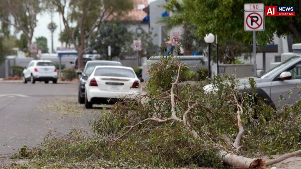
Hail the size of golf balls pummels parts of Arizona as rare storm moves through the West - AI News Breaking
arizona storm drops golfball:
A swath of Arizona was battered on Tuesday by a rare hailstorm that produced balls the size of golf balls, a phenomenon meteorologists say is unusual for the desert region. The National Weather Service (NWS) issued multiple warnings as the storm moved westward, prompting emergency services to respond to reports of damage to vehicles, roofs and agricultural fields. While hail of this magnitude is more common in the central United States during the spring, the combination of intense updrafts and a lingering trough over the Southwest created conditions conducive to the formation of large ice pellets in an area that typically experiences dry, sunny weather.The storm began to coalesce in the early afternoon over the high desert near Prescott, where temperatures were already soaring above 95 °F (35 °C)..
As moist air from the Gulf of California surged northward, it collided with a cold front descending from the Pacific, generating the instability required for strong convection. Radar imagery captured a classic supercell signature, with a rotating updraft that allowed hailstones to remain aloft long enough to accumulate layers of ice. By late afternoon, the hail reached diameters of roughly 1.5 inches (3.8 cm), comparable to a standard golf ball, and began to fall on the surrounding communities.Residents of the Phoenix metropolitan area reported hearing a low, rumbling roar before the hail struck, a sound often described as “the sky breaking.” In the suburbs of Chandler and Gilbert, car windshields were pitted with thousands of tiny dents, and several drivers were forced to pull over as visibility dropped to under 500 feet..
The hail also shattered windows on commercial buildings and dented the metal roofs of warehouses. Local authorities recorded at least 12 emergency calls related to traffic accidents caused by the sudden loss of traction on slick, icy surfaces.Agricultural damage was pronounced in the fertile valleys of the Gila River, where citrus orchards and vegetable farms suffered from the impact of the frozen projectiles. Hail of this size can rupture fruit skins, leaving trees vulnerable to fungal infections, and can shred delicate foliage, reducing photosynthetic capacity for weeks..
The Arizona Department of Agriculture estimated that the storm could cost growers upwards of $2 million in immediate losses, not including longer‑term impacts on yield. Farmers in the area, many of whom have never seen hail of this magnitude, expressed disbelief as they surveyed the flattened leaves and bruised produce.The National Weather Service in Phoenix issued a series of alerts, beginning with a severe thunderstorm warning at 1:45 p.m. local time, followed by a tornado watch for a brief window when the storm’s rotation intensified..
Although no tornadoes were reported, the watch reflected the agency’s caution in a region where tornadoes are rare but not unheard of. Meteorologists highlighted that the storm’s dynamics were amplified by a Madden‑Julian oscillation pulse, a tropical wave that can enhance rainfall and severe weather patterns far from its origin. This, combined with a downstream jet streak, helped sustain the storm’s vigor as it tracked westward toward the Colorado River basin.Emergency management officials activated the Arizona Department of Emergency and Military Affairs’s Incident Command System to coordinate response efforts..
Shelters were opened in affected neighborhoods to accommodate families whose homes suffered roof punctures or window breakage. Utility crews worked through the night to restore power after several substations were knocked offline by hail‑laden downed lines. By midnight, roughly 85 percent of customers had electricity, but officials warned that some rural areas might remain without service for up to 48 hours.Scientists from the University of Arizona’s Department of Atmospheric Sciences seized the opportunity to study the storm’s microphysics..
Lena Martinez, a senior researcher, noted that the hailstones exhibited concentric layers of clear and cloudy ice, indicating multiple cycles of growth and melting within the updraft. “The presence of such large hail in an arid environment suggests that the storm tapped into a deep reservoir of moisture that is not typical for this time of year,” she explained. The research team deployed portable weather radars and hail pads across the affected counties to collect data for a forthcoming study on extreme precipitation events in desert climates.The event has reignited discussion among climatologists about the potential influence of a warming climate on the frequency and intensity of hailstorms in historically dry regions..
While hail formation requires a delicate balance of temperature and humidity, some models predict that an overall increase in atmospheric moisture could expand the geographic range of severe convective storms. However, experts caution that the relationship is complex, and a single event does not constitute a trend. “We need a longer dataset to determine whether this is an outlier or part of a shifting pattern,” said Dr..
Martinez.Local officials urged residents to remain vigilant as the storm system continued its westward trek across Arizona and into California. The NWS warned that additional pockets of severe weather, including strong winds and isolated tornadoes, could develop along the storm’s path over the next 24 hours. Residents in the southern part of the state were advised to secure outdoor objects and keep vehicles under cover if possible..
Meanwhile, schools in the impacted districts postponed afternoon classes, and public transportation schedules were adjusted to accommodate the lingering hazards.As the hailstorm subsided, the aftermath left a stark visual record of the event: streets strewn with a glittering carpet of ice, dented cars glinting under the setting sun, and farmers examining the battered remains of their crops. For many Arizonans, the experience was a reminder of the unpredictable nature of weather, even in a region best known for its dry heat. The coordinated response by emergency services, the swift issuance of warnings by the National Weather Service, and the rapid mobilization of scientific resources highlighted the state’s capacity to manage an unusual and potentially dangerous natural event..
The lessons learned from this rare hailstorm will likely inform future preparedness plans, ensuring that communities remain resilient in the face of increasingly erratic weather patterns..
Updated: October 22, 2026
A rare super‑cell thunderstorm slammed Arizona with golf‑ball‑size hail, damaging cars, roofs and crops and prompting emergency alerts and power outages. Scientists say the unusual event highlights how shifting moisture patterns could bring severe storms to traditionally dry desert regions.
The golf‑ball hail exposes a hidden vulnerability: as a warming climate injects more moisture into desert air, regions once deemed safe from severe convection may face cost‑heavy surprises.
That single storm forces planners to treat “dry‑heat” zones like any other high‑risk area, reshaping insurance, agriculture