
 Tao Tokyo Spring 2027
 Karnataka SIR: Teaching on the back burner
 Trump administration offers mixed messages on limits to Ukraine’s Starshield access
 US Treasury proposes a rule to crack down on high-tech investments in China, other adversaries
 Calley Means, a key MAHA advocate, resigns as a top RFK Jr. adviser
India Officially Names 28 Ladakh Geographical Features China Objects, Renewing Border Tensions
China’s objection to India’s naming of 28 geographical features in Ladakh has renewed attention on the unresolved border dispute, strategic mapping and diplomatic relations between New Delhi and Beijing.
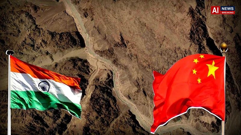
India Officially Names 28 Ladakh Geographical Features China Objects, Renewing Border Tensions - AI News Breaking
india officially names ladakh:
China has strongly objected to India’s decision to standardise the names of 28 geographical features in Ladakh on official maps, describing the move as unilateral and illegitimate. India’s mapping exercise includes strategically significant areas such as Gogra and Hot Springs, which were associated with the 2020 India-China border standoff. The latest disagreement highlights how territorial claims, official maps and border security continue to shape relations between the two Asian powers.
China Protests India’s Decision to Name 28 Ladakh Locations as Border Dispute Continues
China has strongly opposed India’s decision to standardise the names of 28 geographical features in Ladakh, reopening a sensitive chapter in the long-running territorial dispute between the two neighbouring countries. Beijing has described the Indian move as unilateral and illegitimate, while the development underscores India’s efforts to formally document geographical features within its administrative mapping framework.
The disagreement centres on India’s official identification of geographical locations in Ladakh, a strategically important Himalayan region that has remained at the heart of the India-China border dispute. According to reports published in October 2026, the updated mapping exercise includes Gogra and Hot Springs, locations that became internationally significant during the military confrontation between Indian and Chinese troops in eastern Ladakh in 2020.
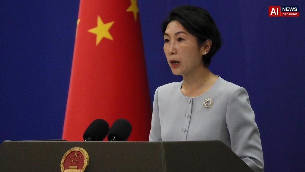
Chinese Foreign Ministry spokesperson Mao Ning criticised India’s decision, reiterating Beijing’s rejection of the administrative status of the Union Territory of Ladakh and opposing what China considers India’s unilateral assertion of territorial claims. India, however, administers Ladakh as a Union Territory and maintains its own position on the boundary and the territories it claims.
The latest exchange demonstrates that even an administrative exercise involving geographical names can carry considerable diplomatic and strategic significance when it takes place in a disputed border region.
Key Highlights
- China objects to India’s mapping exercise: Beijing has rejected India’s standardisation of names for 28 geographical features in Ladakh.
- Gogra and Hot Springs included: The locations are associated with the 2020 military standoff in eastern Ladakh.
- Official Indian mapping: The Survey of India has incorporated the identified geographical features into its official mapping framework.
- Territorial disagreement continues: India and China maintain differing positions on parts of their Himalayan frontier.
- Diplomatic implications: The latest disagreement highlights the importance of border management, military confidence-building and sustained diplomatic engagement.
Why Has China Objected to India’s Naming of 28 Ladakh Locations?
The immediate reason for the latest diplomatic disagreement is India’s decision to standardise the names of 28 geographical features in Ladakh. Such exercises can improve consistency in maps, geographical records, administration and the identification of locations. In a border region where territorial claims overlap, however, official naming can also become politically sensitive.
China’s objection reflects its broader position on the disputed frontier and its refusal to recognise India’s administrative arrangement for Ladakh. Beijing argues that India’s actions cannot determine sovereignty over territory that China claims. The Chinese government has therefore treated the mapping decision as more than a technical or cartographic matter.
India’s position is different. New Delhi administers Ladakh as part of India and maintains that official Indian maps and geographical records should reflect its own administrative framework and territorial claims. The two governments consequently interpret the same exercise through different political and legal perspectives.
It is important to distinguish between naming a geographical feature and establishing internationally accepted sovereignty over it. Standardising a name on an official map does not, by itself, settle a territorial dispute or establish international recognition of a country’s claim. Nevertheless, such decisions can communicate a government’s administrative position and become part of a wider diplomatic contest.
The latest controversy therefore illustrates how cartography, public administration and territorial diplomacy intersect in the Himalayan region.
What Are the 28 Geographical Features Identified by India?
India’s mapping exercise covers 28 geographical features in Ladakh. These include natural landforms and other geographical locations, rather than simply a list of newly established military installations.
Reports on the exercise have identified names including Zorawar Peak, Kanishka Peak, Atisha Giri, Chapchingal Pass, Shachmirk Pass, Skamri Glacier and Yangpa River. Gogra and Hot Springs have also been highlighted because of their association with the India-China military confrontation in 2020.
The locations represent different geographical categories, including peaks, mountains, passes, glaciers, valleys, rivers and other natural features. Their formal identification helps maintain consistency in official geographical records and makes it easier to refer to locations using standardised names.
The inclusion of Gogra and Hot Springs has attracted particular attention because these areas figured prominently in discussions surrounding military disengagement and the management of tensions along the Line of Actual Control, or LAC.
However, the geographical naming exercise should not automatically be interpreted as evidence that new military facilities have been established or that the military situation on the ground has changed. The significance of the development lies primarily in official mapping and the territorial positions that the two countries associate with it.
The Survey of India, the country’s national mapping agency, is central to the official mapping process. The exercise also reflects the importance New Delhi attaches to maintaining formal geographical records for a region with substantial strategic and administrative significance.
Why Ladakh Is Strategically Important for India
Ladakh occupies a critical position in India’s northern frontier. Its high-altitude terrain, mountain passes, valleys and proximity to international borders make it important for national security, military logistics and regional connectivity.
The region shares a sensitive frontier with China and is also located near areas associated with wider regional security concerns. Difficult terrain, harsh winters and limited transport corridors make the movement of personnel, equipment, fuel and essential supplies a significant operational challenge.
For India, accurate geographical records can support civil administration, infrastructure planning, disaster management and security-related coordination. Consistent place names are especially useful when multiple government agencies need to identify the same mountain, valley, river or pass.
The strategic importance of Ladakh became particularly prominent following the 2020 India-China military confrontation. The standoff demonstrated that seemingly remote geographical locations can acquire substantial military significance because of their proximity to patrol routes, access corridors and areas where the two sides maintain competing claims.
India has continued to emphasise infrastructure development and logistical preparedness in its border regions. Roads, bridges, tunnels and other transport facilities can improve access to remote areas, although the practical value of individual projects depends on their location, capacity and operational conditions.
In this context, the formal identification of geographical features contributes to the administrative framework through which India documents and manages the region. It should not, however, be confused with a declaration that all border disagreements have been resolved.
Ladakh’s importance also extends beyond military affairs. Connectivity influences tourism, local livelihoods, access to healthcare, education and the movement of goods. Policies affecting the region can therefore have consequences for both national security and the daily lives of residents.
The latest disagreement with China places these overlapping concerns back in the diplomatic spotlight.
Gogra and Hot Springs: Why These Locations Matter
Gogra and Hot Springs have drawn particular attention because they were among the locations associated with the 2020 India-China military standoff in eastern Ladakh.
The confrontation that year created a serious crisis in bilateral relations. Military deployments increased, diplomatic and military negotiations intensified, and both governments faced pressure to prevent further escalation along the frontier.
The locations became part of wider discussions concerning patrol access, disengagement arrangements and the management of friction points. Their names continue to feature in reporting about the border because they illustrate how local geographical details can become central to broader security negotiations.
The inclusion of these areas in India’s official mapping exercise therefore carries additional political significance. It reinforces the visibility of geographical features that already occupy an important place in India’s security discussions and border-related records.
At the same time, the naming of these locations does not itself demonstrate a new military deployment, a change in control or a breakdown of existing disengagement arrangements. Those conclusions would require separate, independently verified evidence.
Understanding this distinction is essential for interpreting the latest development accurately. The mapping decision is a documented administrative action; its wider military implications should be assessed separately from the diplomatic reaction it has generated.
The dispute also shows why border management requires more than a shared vocabulary. Even when both countries refer to the same geographical feature, they may disagree about the boundary, the interpretation of historical claims and the rights associated with the surrounding territory.
For India and China, managing such differences remains an important part of preventing local disputes from escalating into larger confrontations.
India-China Border Dispute: The Background
The India-China boundary dispute has deep historical roots and involves several sectors of the Himalayan frontier. In the western sector, the dispute includes areas around Ladakh and Aksai Chin. The two countries have differing territorial claims, and the precise alignment of the Line of Actual Control remains contested in several locations.
The 1962 India-China war left a lasting impact on bilateral relations and shaped the security calculations of both governments. Subsequent decades saw attempts to establish mechanisms for managing the disputed frontier and preventing local incidents from developing into major military confrontations.
Agreements reached in the 1990s and later created frameworks intended to maintain peace and tranquillity along the LAC. These arrangements sought to manage military activity, reduce the risk of conflict and provide channels for addressing disagreements.
Nevertheless, the existence of agreements did not resolve the underlying boundary dispute. Differences over the alignment of the LAC, patrol practices and infrastructure development continued to create friction.
The crisis of 2020 marked a major deterioration in relations. The deadly clash in the Galwan Valley resulted in fatalities among Indian and Chinese personnel and led to a prolonged period of heightened military tension. The confrontation also affected broader political, economic and diplomatic engagement between the two countries.
Since then, negotiations have focused on disengagement, restoring stability in sensitive areas and preventing further incidents. These discussions involve military commanders, diplomatic representatives and other official channels.
The latest disagreement over geographical naming is taking place against this background. It is not an isolated cartographic dispute but another manifestation of the competing positions that continue to shape the relationship.
The wider challenge for both governments is to manage their territorial disagreement without allowing every administrative, infrastructural or diplomatic development to become a trigger for escalation.
China’s Position and the Diplomatic Message from Beijing
China’s response reflects its opposition to India’s assertion of administrative authority over Ladakh and its wider territorial claims in the region.
Chinese Foreign Ministry spokesperson Mao Ning reiterated Beijing’s rejection of what it describes as the unilateral establishment of the Union Territory of Ladakh. China also objected to India’s decision to standardise names for the 28 geographical features.
The wording of Beijing’s response is significant because it places the naming exercise within the larger territorial dispute rather than treating it as a routine mapping update. China is seeking to make clear that it does not accept India’s actions as determining the status of the disputed areas.
However, China’s objection does not mean that India’s official mapping exercise has been cancelled, nor does it independently establish Beijing’s claims as legally settled. The two governments continue to advance different positions, and the dispute cannot be resolved by either side’s unilateral statements alone.
For Beijing, the issue also touches on the wider question of how territorial claims are expressed through maps, place names, infrastructure and administrative arrangements. Governments frequently use official geographical records to communicate their understanding of national territory, particularly in contested border regions.
India and China have both objected to each other’s naming exercises in disputed areas in the past. India, for example, has rejected China’s attempts to assign names to locations in Arunachal Pradesh, which India administers as a state and claims as an integral part of its territory.
These competing practices illustrate a broader pattern: geographical naming can become an instrument of political messaging even when it does not immediately change conditions on the ground.
The immediate outcome is diplomatic disagreement. Whether the dispute produces additional consequences will depend on subsequent statements, official decisions and the broader state of border negotiations.
Does Naming a Location Change Territorial Sovereignty?
One of the most important questions raised by the controversy is whether the standardisation of geographical names can alter sovereignty over disputed territory.
The short answer is that naming a location does not, by itself, settle a sovereignty dispute.
Official maps and geographical names are important administrative instruments. They help governments organise territory, maintain records, plan infrastructure and communicate their claims. Yet the international legal status of disputed territory depends on a much wider body of evidence, legal arguments, historical circumstances, agreements and state practice.
A government can use its own official maps to reflect its territorial position, but another country may reject those maps and maintain a competing claim. Such disagreement does not automatically disappear when one side publishes a new map or standardises a place name.
This is particularly relevant to India and China because their boundary dispute involves competing interpretations of the frontier and historical territorial claims. The naming exercise may reinforce India’s administrative position, but it does not replace negotiations or establish a mutually accepted boundary.
The same principle applies to China’s objections. Beijing’s rejection of India’s action communicates its political position, but a diplomatic protest does not, on its own, resolve the underlying legal and territorial questions.
For readers, the distinction between administrative action, territorial claim and internationally accepted settlement is crucial. Headlines that describe the exercise as a complete change in control or a decisive legal victory would go beyond what the naming decision alone establishes.
The more accurate interpretation is that India has formalised geographical names within its official mapping framework, while China has objected because of the disputed territorial context.
Could the Dispute Increase Military Tensions?
The latest exchange adds to the political sensitivity surrounding the India-China frontier, but it does not automatically mean that military escalation is imminent.
Both countries have substantial security interests in the region and have invested in improving access to their respective border areas. Infrastructure, surveillance, troop logistics and patrol arrangements all influence how each side assesses its security environment.
When one government takes an action that the other interprets as strengthening a territorial claim, it can create pressure for a response. That response might take the form of a diplomatic protest, a public statement, a counter-mapping exercise or a change in negotiating posture.
This dynamic is sometimes described as a security dilemma. Measures that one country considers defensive or administrative can be interpreted by the other as threatening, prompting reciprocal actions that make both sides feel less secure.
However, the actual risk of military escalation depends on several factors beyond geographical naming. These include troop deployments, patrol encounters, communications between military commanders, political decisions and the effectiveness of existing crisis-management mechanisms.
There is no basis to conclude from the naming exercise alone that a new military confrontation is underway. Any assessment of a deteriorating security situation would require reliable reporting about events on the ground and official developments.
The immediate priority for both governments is to prevent political disagreement from undermining the mechanisms designed to maintain peace along the LAC.
Clear communication, established military channels and sustained diplomatic engagement can help ensure that administrative decisions do not produce unnecessary misunderstandings or operational miscalculations.
Implications for India’s Foreign Policy
The episode highlights the challenge India faces in balancing territorial firmness with diplomatic stability.
India has consistently maintained its position on Ladakh and its broader territorial claims. Official mapping is one means of documenting that position, alongside administrative governance, infrastructure development and diplomatic engagement.
At the same time, India has a strong interest in avoiding a prolonged period of instability along its northern frontier. A tense border can require additional security resources, complicate diplomatic engagement and create uncertainty for economic and regional cooperation.
The relationship with China is significant for multiple reasons, including trade, manufacturing supply chains, regional security and the wider balance of power in Asia. Border tensions can influence the political environment in which these issues are addressed.
India’s policy challenge is therefore not simply whether to maintain its territorial position. It is also how to deter unwanted changes along the frontier while preserving channels through which disputes can be managed peacefully.
A consistent approach would combine accurate geographical records, defensive preparedness, diplomatic communication and efforts to reduce the risk of accidental escalation.
The latest controversy also demonstrates why public statements need to be assessed alongside practical developments. A strong diplomatic protest can signal a firm position without necessarily leading to an immediate change in military deployments or bilateral engagement.
For India, the effectiveness of its approach will depend on maintaining a clear administrative position while ensuring that the broader border-management process remains functional.
Economic and Regional Consequences
Although the disagreement centres on geography and territorial claims, sustained India-China tensions can have economic and regional implications.
Businesses generally prefer predictable political and security conditions. When relations between two major Asian economies deteriorate, companies may pay closer attention to supply-chain exposure, trade restrictions, investment conditions and the possibility of additional diplomatic friction.
However, it would be premature to attribute any immediate market movement or economic disruption to the latest naming dispute without supporting evidence. A diplomatic protest alone does not establish that trade, investment or financial markets have been materially affected.
The wider relationship remains important because India and China are major participants in regional commerce and manufacturing networks. Decisions affecting trade and investment are influenced by many factors, including domestic policies, global demand, technology restrictions and broader geopolitical developments.
For Ladakh itself, security and connectivity have more direct implications. Improved transport infrastructure can support local economic activity, tourism, emergency services and access to essential supplies. Stable border conditions are also important for communities living in high-altitude areas.
Any prolonged escalation would potentially divert government attention and resources toward security management. Conversely, a stable border environment can give both governments greater room to focus on development and other domestic priorities.
The economic implications of the current dispute should therefore be understood as part of the broader India-China relationship rather than as an immediate consequence of the naming decision.
What Happens Next?
The next stage will depend on how both governments handle the diplomatic disagreement and whether it affects their wider border-management discussions.
China may continue to issue statements rejecting India’s action or reiterating its territorial claims. India, for its part, is expected to maintain its administrative position on Ladakh and its approach to official geographical records.
The more consequential question is whether the disagreement remains limited to diplomatic statements or becomes connected to other developments along the frontier.
Several indicators will matter: statements from the Indian and Chinese foreign ministries, developments in military-level talks, verified reports of changes in deployments, and any new decisions affecting border infrastructure or patrol arrangements.
The continuation of dialogue would not mean that either government had abandoned its territorial position. Rather, it would indicate that both sides were attempting to manage the dispute without allowing it to destabilise the wider relationship.
A negotiated boundary settlement remains a much more complex task than the standardisation of geographical names. It would require sustained political commitment, detailed negotiations and agreement on difficult territorial questions.
Until such a settlement is reached, administrative actions and diplomatic objections are likely to remain part of the broader contest over how each country describes and manages the disputed frontier.
For now, the confirmed development is China’s objection to India’s naming of 28 geographical features in Ladakh. Any further military or diplomatic consequences should be judged on the basis of subsequent verified developments rather than assumptions about what the mapping exercise might lead to.
AI News Breaking Editorial Analysis
The dispute over 28 geographical features in Ladakh demonstrates that modern territorial competition is fought not only through military deployments but also through maps, administrative decisions and diplomatic narratives. India’s standardisation of geographical names reinforces its stated administrative position, while China’s protest reflects its determination to preserve its competing territorial claims.
Neither side’s unilateral position should be mistaken for a final settlement of the border. The larger strategic question is whether both governments can prevent symbolic and administrative disagreements from undermining practical arrangements designed to maintain peace along the Line of Actual Control.
For India, a sustainable approach requires accurate mapping, credible border infrastructure, effective security preparedness and continued diplomatic engagement. For China, rejecting India’s action through diplomatic channels does not remove the need to manage the frontier responsibly. Both countries have significant interests in preventing an avoidable confrontation between two major Asian powers.
The most important measure of progress will be stability on the ground, reliable communication between the two sides and tangible movement toward managing the unresolved boundary. The latest dispute is a reminder that asserting a territorial position and achieving a peaceful, mutually understood settlement are two very different tasks.
AI News Breaking will continue to track verified developments concerning Ladakh, India-China relations and regional security.